SOME HISTORY OF |
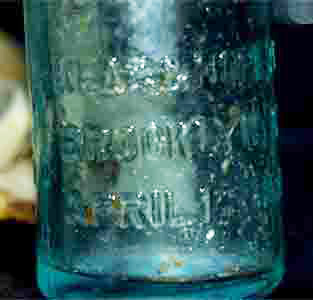
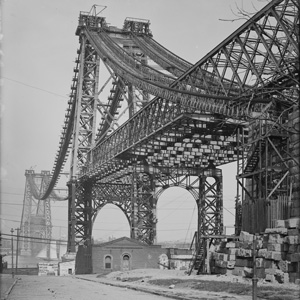
Williamsburg is a neighborhood in the northern portion of the New York City in the borough of Brooklyn in the county of Kings, bordering Greenpoint, Bedford-Stuyvesant, and Bushwick. The Williamsburg Bridge connects the Brooklyn neighborhood to Manhattan Independent Williamsburgh In 1638, the Dutch West India Company claimed ownership of the land and In 1661 chartered the Town of Boswijck, including land that would later become Williamsburg. After the English takeover of New Netherland in 1664, the town's name was anglified to Bushwick. During colonial times, villagers called the area "Bushwick Shore." This name lasted for about 140 years. Bushwick Shore was cut off from the other villages in Bushwick by Bushwick Creek to the north and by Cripplebush, a region of thick, boggy shrubland extending from Wallabout Creek to Newtown Creek, to the south and east. Bushwick residents called Bushwick Shore "the Strand(ed)." Farmers and gardeners from the other Bushwick villages sent their goods to Bushwick Shore to be ferried to New York City for sale via a market at present day Grand St. Bushwick Shore's favorable location close to New York City lead to the creation of several farming developments. In 1802, real estate speculator Richard M. Woodhull acquired 13 acres (53,000 m²) near what would become Metropolitan Avenue, then North 2nd Street. He had Colonel Jonathan Williams, a U.S. Engineer, survey the property, and named it Williamsburgh (with an h at the end) in his honor. Woodhull established a horse ferry from the foot of North 2nd Street to Grand Street in Manhattan. Originally a 13-acre development within Bushwick Shore, Williamsburgh rapidily expanded during the first half of the nineteenth century and eventually seceded from Bushwick and formed its own independent city. Williamsburgh was incorporated as the Village of Williamsburgh within the Town of Bushwick in 1827. In two years it had a fire company, a post office and a population of over 1,000. The deep drafts along the East River encouraged industrialists, many from Germany, to build shipyards around Williamsburgh. Raw material was shipped in, and finished products were sent out of many factories straight to the docks. Several sugar barons built processing refineries. Now all are gone except the now-defunct Domino Sugar (formerly Havemeyer & Elder). Other important industries including shipbuilding and brewing. Reflecting its increasing urbanization, Williamsburgh separated from Bushwick as the Town of Williamsburgh in 1840. It became the City of Williamsburgh in 1852, which was organized into three wards. The old First Ward roughly coincides with the South Side and the Second Ward with the North Side, with the modern boundary at Grand Street. The Third Ward was to the east of these, beginning to approach modern Eastern Williamsburg. more details of williamsburg history at geneology-info.compictures from old Williamsburgweb site of the Giglio Feast / history page
|
 |
 |
|
 |
 |
 |
 |
 |
 |
SIMPLY DIAL 718-486-6916 & Talk to Ivan or Sara |
| brooklynlofts is a registered trademark of paul joffe & brooklyn lofts | electronic mail address: info@brooklynlofts.com or click or simply dial 718-486-6916 & talk to Ivan or Sara |
 |
 |